17 Regions of Spain, Autonomous Communities by Population

There are 17 regions of Spain plus two autonomous cities that form this vast country. These regions or autonomous communities are very diverse in many ways. Some have their own official languages while others have their own local dialects. Often, these areas spread across the country will differ a lot from each other. We will only be covering the 17 regions, not the autonomous cities of Ceuta & Melilla. Both these cities are in Morocco, North Africa.

Starting with the largest population, below are the top regions of Spain. We include useful information about each area such as population and attractions. We will also highlight some of the best things about each region. You can quickly navigation to each region but using the quick links below.

Spanish Regions Map

Below are the main regions of Spain on the map. You can find more maps for Spain here which covers the whole country and islands.

Map of the 17 regions of Spain
Map Of The 17 Regions Of Spain

The 17 Autonomous Communities Of Spain With Provinces

The links below are only intended to give a brief insight into each region. All can be used to quickly navigate around this page. Each region contains important facts such as their population and capital city. You can also find out which provinces help to form them. We also provide some of the top attractions for each region.

Flamenco dancers in Andalucía

Andalucía

Home to the Alhambra, flamenco, and sun-drenched beaches along the Costa del Sol. Experience passion and history in southern Spain.

Learn More
Sagrada Familia in Barcelona

Catalonia

Boasting Barcelona's Gaudí masterpieces, the Costa Brava's coves, and rich cultural heritage. Home to wonderful resorts such as Salou. Lloret de Mar and Blanes.

Learn More
Plaza Mayor in Madrid

Community of Madrid

Spain's vibrant capital. Madrid offers a gateway to the countries diverse regions. Experience the many museums and lively nightlife.

Learn More
City of Arts and Sciences in Valencia

Valencian Community

Birthplace of paella, featuring Valencia's modern architecture and the beautiful Costa Blanca coastline.

Learn More
Rugged coastline of Galicia

Galicia

Known for its lush landscapes, Rías Baixas estuaries and delicious seafood. Home of the historic Camino de Santiago.

Learn More
Duero River in Salamanca, Castile and León

Castile and León

Features significant river routes and reservoirs. These offer a different perspective on Spain's water landscapes inland.

Learn More
La Concha beach in San Sebastián

Basque Country

Renowned for its unique culture, and Michelin-starred cuisine. Home of vibrant cities like Bilbao, San Sebastián and dramatic coastline.

Learn More
Volcanic landscape in Tenerife

Canary Islands

An archipelago of volcanic islands like Tenerife and Gran Canaria. These offer year-round spring climate and diverse landscapes.

Learn More
Farmland & Windmills In Castile La Mancha

Castile La Mancha

Castile La Mancha shares a border with no less than seven other Spanish regions. Home of the beautiful Capital City of Toledo and many amazing attractions.

Learn More
Sunny beach on Costa Cálida, Murcia

Region of Murcia

Discover the unique Mar Menor lagoon and the diverse beaches of the Costa Cálida, known for its warm climate.

Learn More
River landscape in Aragón

Aragón

Offers inland beauty with its rivers and reservoirs. These complement the coastal experiences found elsewhere in Spain.

Learn More
Turquoise bay in Mallorca

Balearic Islands

Including Mallorca, Menorca, Ibiza, and Formentera. Famous for stunning beaches, vibrant nightlife, and natural beauty.

Learn More
Reservoir landscape in Extremadura

Extremadura

While not primarily coastal, Extremadura offers extensive river beaches and reservoirs. These provide unique water-based recreation opportunities.

Learn More
Picos de Europa meeting the sea in Asturias

Asturias

Experience the 'Green Spain' with its stunning natural parks and dramatic coastline. Home of charming fishing villages, and unique cider culture.

Learn More
Green valley in Navarre

Navarre

Features diverse landscapes from Pyrenean peaks to rolling hills and river valleys. These showcase the stunning natural beauty of inland Spain.

Learn More
Colorful houses of Cudillero in Cantabria

Cantabria

Explore the stunning beaches of the Costa de Cantabria. Home of many charming fishing towns, and the prehistoric caves of Altamira.

Learn More
Vineyards in La Rioja wine region

La Rioja

Famous for its world-class wines. La Rioja offers beautiful vineyard landscapes and charming towns, representing Spain's rich gastronomy.

Learn More

Andalusia

Alhambra Andalusia
Alhambra Palace, Andalusia.

Andalusia has the largest population with 8.5 million inhabitants. This massive region covers the second largest landmass and most of southern Spain. The total area of Andalusia is 87,268 km² with a coastline of 945 km’s. Forming this region are 8 different provinces, more than most regions of Spain.

The beautiful city of Seville is the capital of Andalusia and the origin of Flamenco music. This part of Spain is also famous for tapas, incredible fiestas and bullfighting. The climate here is very hot during summer, this is one of hottest parts of the country.

Making up much of the southern coastline is the Costa del Sol, a top holiday destination. This is where you will find some of the best beaches in Spain and many of the top tourism towns. Marbella, Fuengirola, Torremolinos, Benalmádena, Estepona, Málaga and Nerja are all popular areas.

Andalusia boasts some of the best architecture in Spain, both recent and ancient. The Alhambra Palace, Mezquita de Córdoba and La Plaza de España are some examples. The Sierra Nevada mountains are another prominent attraction here.

Andalusia Facts

Flag Flag of Andalucia
Population
8.5 million.

Area & Coastline
87,268 km² with a coastline of 945 km’s.

Provinces
Seville, Málaga, Córdoba, Granada, Cádiz, Almería, Huelva and Jaén.

Capital City
Seville.

Top Attractions
Alhambra. Mezquita de Córdoba. La Plaza de España. Seville Cathedral. Alcazaba de Almeria.

Catalonia

Pyrenees Mountains, Catalonia
Pyrenees Mountains, Catalonia.

Catalonia accounts for 7.4 million people and has a landmass of 32,114 km². This region of Spain has the second largest population which is one of the more diverse. Unlike Andalucia, there are several other official languages other than Spanish. Depending on the area, the people speak Catalan, Occitan (Aranese) and Catalan sign language.

There are four provinces that form Catalonia, Barcelona, Girona, Lleida and Tarragona. There are 560 km’s that stretch the coastal areas of this region. Barcelona is both the capital and largest city of Catalonia with a population of 1.6 million people. The province of Barcelona has a population of 5.5 million people.

The climate here is also very diverse with the inland areas usually warmer. Lleida and Girona both share borders with the Pyrenees Mountains. Here the temperature is much colder than the southern and coastal areas.

Two of popular Spanish Costas help to form the coastal areas of Catalonia. The Costa Brava runs along the northeast coastline with the Costa Dorada to the south. Lloret de Mar, Tossa de Mar and Blanes are some of the top areas the Costa Brava has to offer. Blanes and Salou are two of the best areas on the Costa Dorada coastline. Salou is also the home to the famous Portaventura World theme park.

Many of the most famous buildings of Catalonia are works of architect Antoni Gaudí. Sagrada Familia, Park Güell, La Rambla and Casa Milà are a few of his masterpieces.

Catalonia Facts

Flag
Flag of Catalonia
Population
Catalonia has the second largest population of the regions of Spain with 7.4 million people..

Languages
Spanish, Catalan, Occitan (Aranese) and Catalan Sign Language.

Area & Coastline
Area of 32,114 km² with a coastline of 699 km’s.

Provinces
Barcelona, Girona, Lleida and Tarragona.

Capital City
Barcelona.

Top Attractions
Sagrada Familia. Park Güell. La Rambla. Bellesguard. Artigas Gardens. Casa Milà.

Community Of Madrid

Plaza Mayor, Madrid
Plaza Mayor, Madrid.

For it’s small size, the Community of Madrid has a big population of 6.5 million. This Spanish region covers an area of only 8,028 km². Considering it’s size, there is only one province that forms the Community of Madrid.

Despite it’s small size, the capital city of Madrid is the third biggest city in the Eurozone. Only London in the UK and Berlin in Germany have bigger populations. Around 3.1 million people of the total population of the region live within the city limits.

Madrid is landlocked and as a result does not have any coastline. This popular city is also the capital of the kingdom of Spain. The capital only recognises Castilian or Spanish as the official language.

Most of Madrid sits at an altitude of over 600 metres above sea level. As a result, the weather is very hot in summer but cold in winter. The hot weather can be stifling due to the massive population and high humidity. Madrid has seen a record cold temperature of -15 Celsius during winters.

Being one of the top capital cities in the world there is no shortage of amazing architecture. The Royal Palace of Madrid, National Museum Del Prado and Plaza Mayor are among the best.

Madrid Facts

Flag
Flag of Madrid
Population
The Community of Madrid has a population of 6.5 million people.

Languages
Castilian Spanish.

Area & Coastline
Area of 8,028 km² with no coastline.

Provinces
The Community of Madrid does not have provinces but is split into districts.

Capital City
Madrid is both the capital of the Community of Madrid and the kingdom of Spain.

Top Attractions
The Royal Palace of Madrid. National Museum Del Prado. Plaza Mayor. Puerta de Sol. Gran Via.

Community Of Valencia

City of Arts & Sciences, Valencia
City of Arts & Sciences, Valencia.

The Community of València is the fourth most populated region with 5 million people. This region covers an area of 23,255 km² with 518 km’s of coastline. The Community of València consists of three provinces, València, Alicante and Castellón. València is also the capital city of this beautiful part of Spain.

Spanish and Valèncian are both official languages of this region. Although around 2 million speak Valèncian, it’s compulsory to learn at school. It’s also a mandatory to speak for certain jobs such as police, fire and hospital services.

This part of Spain is rich in culture and one of the top places to visit. The world famous Paella and several other popular dishes come from this region. Along the coastline are some of the top beaches and tourism locations.

The southern areas is where the popular Costa Blanca lies which accounts for 200 km’s of coastline. Some of the top cities here include Benidorm, Torevieja, Elche, and Orihuela.

The climate can vary depending where you are. The northern areas are more mountainous and tend to get cooler temperatures. Further south the temperature is usually a touch warmer. The winters here are mild and the summers are always hot. There are parts of the southern Costa Blanca that enjoy a warm micro-climate. This is especially true for places such as the Orihuela Costa and Torrevieja.

The Community of Valencia boasts amazing attractions, ancient, modern and natural. The City of Arts and Sciences and L’Oceanographic are two of the most modern structures. There are many natural attractions here such as Canelobre Caves and Algar Waterfalls.

Valencia Facts

Flag
Flag of Valencia
Population
The Community of València is the fourth most populous of the regions of Spain with 5 million people.

Languages
Castilian Spanish, Valèncian.

Area & Coastline
Area of 23,255 km² with 518 km’s coastline.

Provinces
There are three provinces which form the Community of València, Alicante, València and Castellón.

Capital City
València is the capital of the Community of València.

Top Attractions
City of Arts and Sciences. L’Oceanographic. Algar Waterfalls. Canelobre Caves.

Galicia

Santiago de Compostela Cathedral, Galicia
Santiago de Compostela Cathedral, Galicia.

Fifth on our regions of Spain list takes us to Galicia in the northwest. This interesting region has a population of 2.7 million and shares a border with Portugal.

Galicia covers an area of 29,574.4 km² and a coastline of 1498 km’s. Known  as the Costa Verde, this is by far the biggest coastline of mainland Spain. Only the Canary Islands has a longer coastline once you combine all the islands. This region has the Atlantic Ocean to the west and the Cantabrian Sea to the north.

Four provinces make up Galicia which are A Coruña, Lugo, Ourense and Pontevedra. Galicia also has it’s own official language as well as Castilian Spanish. Santiago de Compostela is the capital city of this region of Spain.

Portugal and Galicia were part of the then-called Kingdom of León before it’s breakup in 1139. As a result, Galician bears many similarities to the Portuguese language.

This is one of the greener and wetter areas of Spain and the temperatures reflect this. A Coruña and Lugo tend to be colder during summer while Ourense and Pontevedra are warmer. Winter does not follow the same pattern one would expect. Lugo and Ourense tend to be the coldest provinces during winter.

Galicia is truly beautiful with hundreds of miles of unspoiled coastline. In these coastal areas there are many fantastic beaches and coves to explore. If you are looking for architecture then head to the capital and check out Santiago de Compostela Cathedral. Other great attractions include the Roman Walls of Lugo and the Tower of Hercules. The latter is the oldest Roman lighthouse still in use.

Galicia Facts

Flag
Flag of Galicia
Population
Galicia is the fifth most populous of the regions of Spain with 2.7 million people.

Languages
Castilian Spanish, Galician.

Area & Coastline
Area of 29,574.4 km² with 1498 km’s of coastline.

Provinces
A Coruña, Lugo, Ourense and Pontevedra.

Capital City
Santiago de Compostela.

Top Attractions
Santiago de Compostela Cathedral. Tower of Hercules. Monte de Gozo. Roman Walls of Lugo.

Castile and León

Salamanca Plaza, Spain
Salamanca Plaza, Salamanca, Castile & León.

Castile and León is the sixth most populous of the regions of Spain. This region is actually the largest of all making up 18.6% of the country. The total area coverage is a massive 94,223 km². The population of 2.4 million is tiny when you consider the vastness of this region.

Forming the region of Castile and León are 9 different provinces. These are Ávila, Burgos, León, Palencia, Salamanca, Segovia, Soria, Zamora and Valladolid. There is no official capital city although most consider this to be Valladolid.

Castile and León has no coastline but shares quite a big border with Portugal to the west. This area also shares a border with 9 other regions of Spain. Castile and León has a border with Extremadura, Madrid and Castile la Mancha to the south. To the north are borders with Asturias, Cantabria, Basque Country and La Rioja. To the west is Galicia and to the east is Aragon.

Portugal and Galicia were part of the then-called Kingdom of León before it’s breakup in 1139. As a result, Galician bears many similarities to the Portuguese language.

The climate here tends to vary a lot from province to province. The summers are usually warm but winters can be very cold. This is especially true around the northern and mountainous areas. The Catabrian Mountains for example has a much colder yearly climate than southern areas.

Being such a vast area there are far too many great attractions to list. Alcázar of Segovia, Aqueduct of Segovia, Las Médulas, Burgos Cathedral and New Cathedral of Salamanca are a few.

Castile and León Facts

Flag
Flag of Castile and Leon
Population
Castile and León is the sixth most populous of the regions of Spain with 2.4 million people.

Languages
Castilian Spanish. Leonese and Galician unofficial languages.

Area & Coastline
Area of 94,223 km² with no coastline.

Provinces
Ávila, Burgos, León, Palencia, Salamanca, Segovia, Soria, Zamora and Valladolid.

Capital City
Valladolid (unofficial).

Top Attractions
Aqueduct of Segovia, Las Médulas, Burgos Cathedral and New Cathedral of Salamanca.

Basque Country

Basque Country Coastline
Basque Country Coastline.

The Basque Country is the seventh most populous of the regions of Spain. This diverse region has a rich history and one of the most thriving economies. Making up this part of northern Spain are the provinces of Álava, Biscay and Gipuzkoa. The northern areas have a 246 km coastline which runs along the Bay of Biscay.

The Basque Country has a population of 2.2 million and covers an area of 7,234 km². Close to half the total population live in the metropolitan areas of Bilbao. There is no official capital city but many consider this title to belong to Vitoria-Gasteiz. Spanish and Basque are the two official languages spoken here.

This region boasts many beautiful cities such as Bilbao, Vitoria-Gasteiz and San Sebastián. Bilbao is the biggest city in the province of Biscay and the Basque Country.

Most of the Basque Country is green with a wet yearly climate. The northern areas of the country are known as green Spain for this reason. The winters are usually cold and wet with warm summers. This depends on which part of course, the mountainous areas are colder.

The top attraction here include Bilbao Cathedral and the Guggenheim Museum in Bilbao. Beach lovers are in for a treat with Playa de La Zurriola and the amazing La Concha Beach.

Basque Country Facts

Flag
Flag of Basque Country
Population
Population The Basque Country is the seventh most populous of the regions of Spain with 2.2 million people.

Languages
Castilian Spanish. Basque.

Area & Coastline
Area of 7,234 km² with a 246 km coastline.

Provinces
Álava, Biscay, Gipuzkoa.

Capital City
Vitoria-Gasteiz (unofficial).

Top Attractions
Bilbao Cathedral, Guggenheim Museum, Bilbao, Playa de La Zurriola, La Concha Beach.

Canary Islands

Teide, Tenerife
Teide National Park, Tenerife.

The Canary Islands form the longest coastline of Spain. The total length once we combine the coastline of each island is 1,583 km’s. These sub-tropical islands in the Atlantic Ocean have a population of 2.1 million. This is the eighth most populous of the regions of Spain which cover an area of 7,447 km².

Forming the Canaries are seven main islands and several smaller islets. Most will be familiar with the island of Tenerife, Gran Canaria, Lanzarote and Fuerteventura. The three other main islands are La Palma, La Gomera and El Hierro. The smaller islets are Isla de Lobos, Montaña Clara, La Graciosa, Alegranza, Roque del Oeste and Roque del Este.

Spanish is the official language here but Canarian is their local dialect. The island of La Gomera also has an official language which involves whistling. Silbo Gomero is still in use today. This method of whistling can carry a message for up to 5 km’s across deep ravines.

Each of the Canary Islands offer something different but all have one thing in common. A sub-tropical climate where it hardly ever gets cold. Islands of Eternal Spring and The Fortunate Isles are two names often associated with the Canaries.

The Canary Islands welcome over 10 million visitors every year from all over the world. These islands are especially popular with northern Europeans. Millions travel south to the warmer islands in winter and spring for guaranteed sun.

There are two capital cities here which claim the status every four years. Santa Cruz de Tenerife and Las Palmas de Gran Canaria share this status.

The top attractions in Tenerife are Loro Parque, Siam Park and Teide National Park. Palmitos Park and the Botanical Gardens are super attractions in Gran Canaria. For Lanzarote there is Timanfaya National Park and Cueva de los Verdes. Oasis Park and Isla de Lobos are among the top things to do on the island Fuerteventura but there are many super beaches also.

Canary Islands Facts

Flag
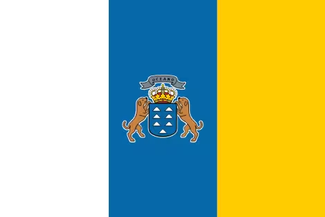
Flag of Canary Islands
Population
Population The Canary Islands are the eighth most populous of the regions of Spain with 2.1 million people.

Languages
Castilian Spanish. Canarian Dialect. Silbo Gomero.

Area & Coastline
Area of 7,447 km² with a 1,583 km coastline.

Islands
Tenerife Gran Canaria Fuerteventura Lanzarote La Palma La Gomera El Hierro.

Capital City
Las Palmas de Gran Canaria and Santa Cruz de Tenerife. (The capital changes every 4 years with Parliament).

Top Attractions
Loro Parque, Siam Park and Teide National Park (Tenerife).

Palmitos Park, Botanical Gardens (Gran Canaria).

Timanfaya National Park, Cueva de los Verdes (Lanzarote).

Oasis Park, Isla de Lobos (Fuerteventura).

Castile La Mancha

Toledo City
Toledo City, Castile La Mancha.

Castile La Mancha is the last of the regions of Spain which has a population of over 2 million. This massive region accounts for much of the centre of Spain which is spread over an area of 79,463 km². This is the third biggest region for landmass behind Castile and León and Andalucia.

Forming this region are the provinces of Toledo, Albacete, Ciudad Real, Cuenca and Guadalajara. Toledo is the capital city of Castile La Mancha. Given the size of this region, the population of just over 2 million is small in comparison to other regions.

Castile La Mancha does not have a coastline as it shares a border with seven other regions. These are Castile and León, Madrid, Aragon, Valencia, Murcia, Andalucia, and Extremadura. The official language of the region is Castilian Spanish.

The lack of coastline makes the climate here quite arid during summer. In winter, much of this region can get quite cold with extreme heat in summer.

The top attractions here include Toledo Cathedral, Hanging Houses of Cuenca, Alcázar of Toledo and Monastery of San Juan de los Reyes.

Castile La Mancha Facts

Flag
Flag of Castile La Mancha
Population
Population Castile La Mancha is the ninth most populous of the regions of Spain with 2 million people.

Languages
Castilian Spanish.

Area & Coastline
Area of 79,463 km² with no coastline.

Provinces
Albacete, Ciudad Real, Cuenca and Guadalajara.

Capital City
Toledo.

Top Attractions
Toledo Cathedral, Hanging Houses of Cuenca, Alcázar of Toledo, Monastery of San Juan de los Reyes.

Region Of Murcia

Murcia City
Murcia City.

Murcia is the first of our regions of Spain which has a population of less than 2 million. This region lies south of the community of Valencia and east of Castile La Mancha. The region of Murcia also has borders with the provinces of Almeria and Granada. Both these provinces are part of the region of Andalucia.

Murcia currently has a population of 1.5 million and covers an area of 11,313 km². The 274 km’s of coastline are known as the Costa Cálida or “Warm Coast”. The capital of this region is the city of Murcia which lies inland from the coastal areas.

The ancient city of Cartagena is one of the oldest in Spain with deep roots to the Roman Empire. Cartagena is not only a major city of this region but it’s also the location for one of Spain’s most important ports.

The coastal area of this region is also home to the biggest natural lake in Spain. The Mar Menor is also the largest salt lagoon in Europe. A small strip of land separates the Mar Menor from the Mediterranean Sea.

The climate here is always warm hence the name “Warm Coast”. The winters are mild but in summer this is one of the hottest parts of Spain. Towns such as Fortuna which sits 192 metres above sea level get very hot. The inland areas are quite arid with little yearly rainfall.

Murcia Facts

Flag
Flag of Murcia
Population
The Region of Murcia is the tenth most populous of the regions of Spain with 1.5 million people.

Languages
Castilian Spanish.

Area & Coastline
Area of 11,313 km² with 274 km’s coastline.

Provinces
Murcia is the only province here.

Capital City
Murcia.

Top Attractions
Mar Menor, La Manga Strip, Los Alcazares Air Show, Roman Theatre of Cartagena.

Aragón

Pyrenees National Park
Pyrenees National Park, Aragón.

Aragón is a large Spanish region by landmass but has a small population by comparison. This region shares a border with many others which includes Castile and León and Castile La Mancha. Catalonia, Navarre and Valencia to the south are three more regions in which Aragón shares a border. There is also a border with La Rioja which is one of the smallest regions of Spain. There is no coastline as such as the Pyrenees Mountains borders Aragón from the north.

The population of Aragón is 1.3 million with many inhabitants living in the three main provinces. These are Zaragoza, Teruel and Huesca with Zaragoza also being the capital of the region. Aragón is a popular location with fishermen as the River Ebro flows through this region. Aragón covers an area of 47720 km² (18420 square miles) which is the fourth largest Spanish region by landmass.

The ancient city of Cartagena is one of the oldest in Spain with deep roots to the Roman Empire. Cartagena is not only a major city of this region but it’s also the location for one of Spain’s most important ports.

The coastal area of this region is also home to the biggest natural lake in Spain. The Mar Menor is also the largest salt lagoon in Europe. A small strip of land separates the Mar Menor from the Mediterranean Sea.

The climate here is always warm hence the name “Warm Coast”. The winters are mild but in summer this is one of the hottest parts of Spain. Towns such as Fortuna which sits 192 metres above sea level get very hot. The inland areas are quite arid with little yearly rainfall.

Aragón Facts

Flag
Flag of Aragón
Population
The Region of Aragón is the eleventh most populous of the regions of Spain with 1.3 million people.

Languages
Castilian Spanish. Aragonese, Catalan.

Area & Coastline
Area of 47,720 km² which is the fourth largest in Spain.

Provinces
Huesca, Zaragoza, Teruel.

Capital City
Zaragoza.

Top Attractions
Basilica of Nuestra Senora del Pilar. Ordesa y Monte Perdido National Park. Aljafería Palace.

Balearic Islands

Palma de Mallorca
Palma de Mallorca City, Mallorca, Balearic Islands.

Forming the Balearic Isles are four main islands and over 100 smaller islets. The largest of these islands is Majorca or Mallorca to many of us. Completing the major islands we have Menorca, Ibiza and Formentera. There are currently 1.2 million inhabitants across the islands.

The capital city of Palma de Mallorca is both the capital of the Balearics and Majorca. Most of the inhabitants speak both Catalan and traditional Spanish in general here. The Balearics coastline covers a distance of 1,723 km across the islands.

Balearic Islands Facts

Flag
Flag of Balearic Islands
Population
The Balearic Islands region has a population of 1.2 million.

Languages
Castilian Spanish. Catalan.

Area & Coastline
Area of 4,992 km² with 1723 km’s coastline.

Islands
Mallorca, Ibiza, Menorca, Formentera.

Capital City
Palma de Mallorca.

Top Attractions
La Seu, Mondragó Park, Santuari de Lluc, Cuevas del Drach.

Extremadura

Roman Theatre, Extremadura
Roman Theatre, Extremadura.

Extremadura is one of the most western regions which shares it´s west border with Portugal. There are currently 1.06 million people covering an area of 41,634 km² (16,075 square miles). For landmass, this is the fifth largest of the Spanish regions. Extremadura borders Castile and Leon to the north and Castile La Mancha to the east. Landlocking Extremadura to the south is Andalucia.

Extremadura is an important part of Spain for wildlife conservation. There are several larges natural parks here such as Monfragüe and Tagus River Park. The capital city here is Mérida with Badajoz and Caceres also major cities and provinces. The capital was once one of the most important places of the Roman Empire. As a result there a plenty of Roman ruins such as the Roman Theatre (Teatro Romano). La Alcazaba and Plasencia are major landmarks to look out for.

Extremadura Facts

Flag
Flag of Extremadura
Population
Extremadura has a population of 1.05 million.

Languages
Castilian Spanish.

Area
Area of 41,634 km².

Provinces
Badajoz and Cáceres.

Capital City
Mérida.

Top Attractions
Roman Theatre (Teatro Romano), La Alcazaba and Plasencia.

Asturias

Cantabrian Mountains, Asturias
Cantabrian Mountains, Asturias.

Asturias is one of the smaller regions of northwest Spain next to Galicia. This autonomous community is famous for being one of the greenest parts of the country. The coastal areas here are also part of the Costa Verde or “Green Coast”.

The population of Asturias is a little over 1 million inhabitants currently. Around half of the population here live in the Capital Oviedo and Gijón. The latter actually has more permanent inhabitants with 270 k in comparison to Oviedo´s 220 k.

One of the top attractions of this Spanish region is the Cantabrian Mountain range and park which also run through Cantabria and Galicia. Their name in the Spanish language is “Picos de Europa” (peaks of Europe). Asturias is another region which also has it´s own local dialect. Asturian or “Asturiano” is still spoke today is much of Asturias.

Asturias Facts

Flag
Flag of Asturias
Population
The population of Asturias is 1 million.

Languages
Castilian Spanish, Asturian.

Area & Coastline
Area of 10,604 km² with 401 km’s coastline.

Provinces
Principality of Asturias is the only province here.

Capital City
Oviedo.

Top Attractions
Cantabrian Mountains & Picos de Europa National Park. Oviedo Cathedral. Lakes of Covadonga.

Cantabria

Santander, Cantabria
Santander, Capital of Cantabria.

For population, Cantabria is the second smallest with some 580 k inhabitants. This region lies on the northern coast east of Asturias and west of Baque Country. The southern areas of Cantabria border the massive region of Castile and León. Santander is the capital city here and also a port on the Bay of Biscay.

This is a popular area for hiking with the Cantabrian Mountains passing through here. We also have Picos de Europa National Park. There are also many different cave systems with ancient drawings. The Altamira Caves are one such example and a World Herritage Site.

Cantabria Facts

Flag
Flag of Cantabria
Population
The population of Cantabria is 580 K.

Languages
Castilian Spanish.

Area
5,325 km².

Provinces
Only Cantabria.

Capital City
Santander.

Top Attractions
Castro Urdiales, Altamira Museum, Santillana de Mar.

La Rioja

la Rioja, Spain
Province of La Rioja, Spain

We at last come to La Rioja which is by far the smallest region of Spain for population. There are some 314 k people living in this area which covers 5,045 km². Wine lovers will know this region is one of the most important in the country for wine production. There are many vineyards in this part of Spain.

Logroño is the capital city of La Rioja which lies below Bilbao. One interesting fact is the locals say this is where Castillian Spanish was first written down. This was over 1000 years ago in the monastery of San Millán de la Cogolla.

La Rioja Facts

Flag
La Rioja
Population
The population of La Rioja is 314 K.

Languages
Castilian Spanish.

Area
5,045 km².

Provinces
Only La Rioja.

Capital City
Logroño.

Top Attractions
Co-Cathedral of Santa María de la Redonda, Monastery of San Millán de Yuso.